
This article has been archived
BricsCAD adds support for ESRI Maps
BricsCAD V24.2.07 has introduced an exciting new feature—support for ESRI maps through its GEOMAP command. This update enhances the software’s geospatial capabilities, providing user with the option of pulling Aerial or Street map imagery dynamically into the background of their drawing.
This change is timely, as previous releases only supported Bing Maps, which is no longer accessible for new users. For existing users access will continue to be available until the 30th June 2025. We recommend that you make the move to using ESRI maps as soon as possible.
So, what do you need to do to be able to take advantage of this new feature?
Get BricsCAD V24.2.07 or later
Firstly, you need BricsCAD V24.2.07 or later to access this new functionality with the GEOIMAGE command. If you're not sure what version of BricsCAD you have installed, simply run the ABOUT command, which will tell you what version you have installed.
Declare your drawing's location
For GEOMAP to work it needs to know the physical location of your drawing relative to a map grid coordinate system. This can be done using the GEOGRAPHICLOCATION command. You will find that all the common New Zealand coordinate systems are included.
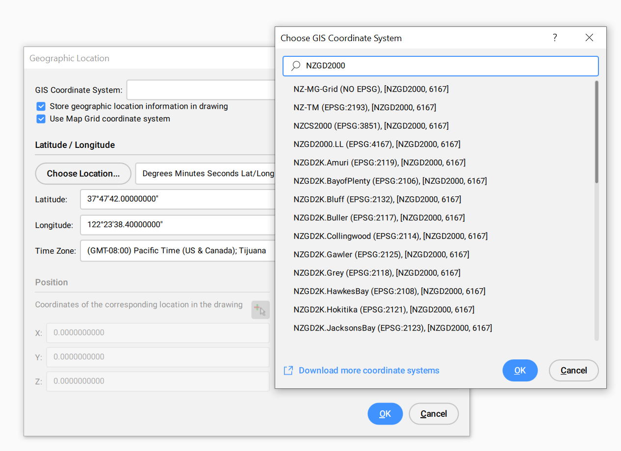
We recommend that you check the options to store the geographic location in your drawing, and use the Map Grid coordinate system.
NOTE. If you're working with existing drawings data, you will need to know what map grid it was created to and set the details in GEOGRAPHICLOCATION to match. If you assign the wrong coordinate system you will find that the imagery won't line up with your drawing data. If you're working with data sourced from the LINZ Data service, then you assign your coordinate system when you download content.
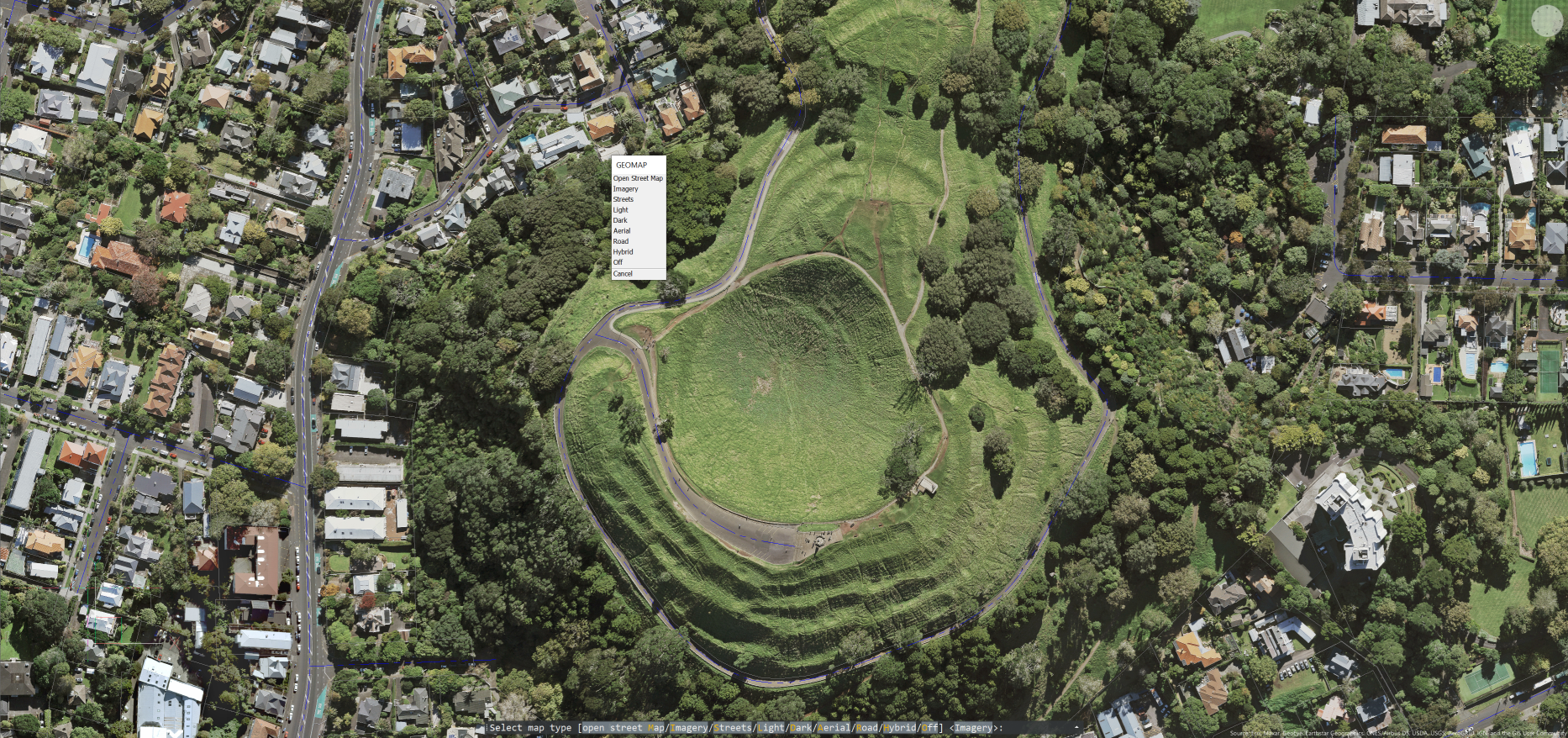
Using GEOMAP
With your GEOGRAPHICLOCATION set your ready to use GEOMAP. The command gives options for a variety of image types.

Once you've selected an image type you should see it appear in your drawings background and it will dynamically update as you zoom and pan around.

Geomap images are intended for use a visual reference in model space, as such you will find that the imagery is not included with printing. If you want to use an area of your Geomap in a form that can be printed, then you can use the GEOMAPIMAGE command to capture it as a static geographic map image.
Tip - Sign up for an ESRI key
To get the maximum use out of GEOMAP command it's recommended that users sign up for an ESRI account and create an ESRI key, which you enter into BricsCAD using the GEOMAPKEY command. Details on how to do this can be found here in the BricsCAD Help system.
Ready to Transform Your CAD Workflow?
Contact us today to discover how CAD Concept's first-rate support and expert training can elevate your design process.